The workshop was planned for the end of the project, but given the quality and number of applications submitted, it grew into an international conference held in Dubrovnik in September 2017. The result of the conference is a book available as an OS.
Mapping urban changes / Mapiranje urbanih promjena
 Mapping urban changes / Mapiranje urbanih promjena
Edited by / uredila: Ana Plosnić Škarić
Reviewers / Recenzenti: Ivo Babić, Bojana Bojanić Obad Šćitaroci
ISBN 978-953-7875-45-9
Institute of Art History / Institut za povijest umjetnosti
Zagreb, 2017
Download the pdf here: Mapping_urban_changes_Mapiranje_urbanih_promjena
ducac project international conference – mapping urban changes
please find attached the mapping_urban_changes_international_conference_programme_and_book_of_abstracts
programme
international conference organised by the Institut za povijest umjetnosti / Institute of Art History, Zagreb, Hrvatska / Croatia
Centre for Advanced Academic Studies, University of Zagreb
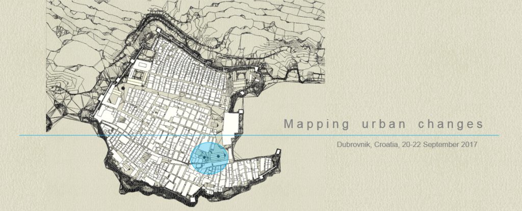
Don Frana Bulića 4, Dubrovnik, Croatia
20-22 September 2017
The aim of this conference is to compare and discuss methodologies of research and the methodologies of visualisation of the results achieved within the urban history studies. The conference gathers researchers from different disciplines, like art and architectural history, urban development studies, economic, social and political history and archaeology, offering multidisciplinary approaches. It gathers the researchers from the scientific and research institutions, as well as independent researchers, from Belgium, Canada, Croatia, Germany, Ireland, Israel, Italy, Slovenia, Spain, United Kingdom, and the United States of America. The papers are divided into eight groups, accordingly to the most distinctive methodology that is discussed in them: City in its historical maps and images, Urban form in archival sources, Texts and maps, Projecting archival data on maps, Processing data with GIS, Integrated sources for urban development research, Challenges of 3D and 4D reconstructions, New data collecting methodologies. The Introduction lecture on Dalmatian urbanism research is given by prof. dr.sc. Ivo Babić, and the Closing lecture and the Conclusions of the conference Mapping urban Changes is given by prof.dr.sc. Bojana Bojanić Obad Šćitaroci.
The conference is organized within the project “Dubrovnik: Civitas et Acta Consiliorum. Visualizing Development of the Late Medieval Urban Fabric”; see more at ducac.ipu.hr/, of the Institut za povijest umjetnosti / Institute of Art History, Zagreb Hrvatska / Croatia, founded by the Hrvatska zaklada za znanost / Croatian Science Foundation. The conference is supported by the Hrvatska zaklada za znanost / Croatian Science Foundation, the Ministarstvo znanosti i obrazovanja Republike Hrvatske / Ministry of Science and Education of the Republic of Croatia, the Turistička zajednica Dubrovnik / Dubrovnik Tourist Board, and the Istituto Italiano di Cultura / Talijanski institut za kulturu.
![]()
organisers: Ana Plosnić Škarić and Danko Zelić
scientific committee: Donatella Calabi, Alessandra Ferrighi, Nada Grujić, Ana Marinković, Ana Plosnić Škarić, Danko Zelić
20/9/2017
8 30 – 9 00 Registration (fee: 55 euros; for paying the fee contact muc@writeme.com)
9 00 – 9 15 Opening of the Conference Mapping urban changes & the Exhibition of the ducac project
9 15 – 9 45 Ivo Babić, Faculty of Architecture and Construction, University of Split, Croatia
The introduction lecture. Dalmatian urbanism research
10 – 11 30 City in its historical maps and images
Moderator/Chair: Danko Zelić
Dubrovnik: Reality of the maps
Ilario Principe, Università di Firenze, Reggio Calabria e Cosenza
Perspectives or how to deal with complexity: The case of Melchior Lorck’s Prospect of Constantinople
Elke Katharina Wittich, AMD Akademie Mode & Design, Hamburg, Germany
The transformation of the Split Peristyle during the 13th century
Joško Belamarić, Institute of Art History – Centre Cvito Fisković, Split, Croatia
11 30 – 12 00 Coffe break
12 00 -13 30 Urban form in archival sources
Moderator/Chair: Francesco Bettarini
Palazzo stupendo et magnifico et superbo: Rector’s Palace in Dubrovnik between 1400 and 1450
Nada Grujić, Faculty of Humanities and Social Sciences, University of Zagreb, Croatia
Locating and analysing the appearance of private houses in the 15th century Dubrovnik: The case of Georgio de Gozze house
Renata Novak Klemenčič, Faculty of Arts, University of Ljubljana, Slovenia
Monastic enclosure as urban feature: Mapping conventual complexes vs. public space in early modern Dubrovnik
Ana Marinković, Faculty of Humanities and Social Sciences, University of Zagreb, Croatia, & Zehra Laznibat, Conservation Department in Dubrovnik, Republic of Croatia Ministry of Culture
The debate on the urban development of the medieval Rab – next step: The sources and the evidence
Dušan Mlacović, Faculty of Arts, University of Ljubljana, Slovenia
13 30 – 15 30 Break
15 30 -17 00 Texts and maps
Moderator/Chair: Heidi Deneweth
Dubrovnik: Civitas et Acta Consiliorum 1400–1450. Mapping methodology and data analysis
Ana Plosnić Škarić, Institute of Art History, Zagreb, Croatia, & Alessandra Ferrighi, Università IUAV di Venezia, Italy
Una Omnes: literary academies in Milan between the XVI and the XVII century
Alessandro Corsi, Università Cattolica del Sacro Cuore of Milan, Italy
Spaces of power in interregnum Aberdeen
Edda Frankot, University of Aberdeen, UK
Shifting urban atmospheres; Saint Petersburg’s literary context
Angeliki Sioli, Louisiana State University, USA
17 00 -17 30 Coffe break
17 30 – 19 00 Projecting archival data on maps
Moderator/Chair: Renata Novak Klemenčič
Digital mapping of noble estates in Dubrovnik’s burgus (13th‐century)
Irena Benyovsky Latin, Croatian Institute of History, & Ivana Haničar Buljan, Institute of Art History, Zagreb, Croatia
Digitalizing Renaissance Florence
Francesco Bettarini, Neubauer Collegium, University of Chicago, USA
Medieval urban landscape of the northern part of the city of Dubrovnik
Danko Zelić, Institute of Art History, Zagreb, Croatia
Mapping housing market in late medieval Dubrovnik: The Saint Nicholas sexterium (ca. 1420 – 1450)
Matko Matija Marušić, Institute of Art History, Zagreb, Croatia
21/9/2017
9 00 – 10 30 Processing data with GIS
Moderator/Chair: Alessandra Ferrighi
Felix Arba – reconstructing urban and rural economic capacities through GIS
Goranka Lipovac Vrkljan, Institute of Archaeology, Zagreb, Croatia, & Ana Konestra, Institute of Archaeology, Zagreb, Croatia, & Nera Šegvić, Faculty of Humanities and Social Sciences, University of Zagreb, Croatia
Visualising urban social change, Bruges (Belgium) 1300‐1700
Heidi Deneweth, Vrije Universiteit Brussel, Belgium, & Ward Leloup, Vrije Universiteit Brussel, Belgium, & Mathijs Speecke, Ghent University, Belgium
From guessing to “gissing”: HisGIS analysis for mapping urban transformation and military reuse of suppressed convents in Brussels, Antwerp and Bruges (1773‐1860)
Reinout Klaarenbeek, University of Leuven, Belgium, & Thomas Coomans, University of Leuven, Belgium
10 30 – 11 00 Coffe break
11 00 – 12 30 Integrated sources for urban development research
Moderator/Chair: Ana Marinković
Ottoman Jaffa: From pilgrims’ anchorage to regional center
Yoav Arbel, Israel Antiquities Authority
Bedford Park: Ruralism and the construction of heterotopic space in London’s suburban margin
Simon Knowles, University College Cork, Ireland
Trogir and its suburbs
Dunja Babić, Faculty of Civil Engineering, Architecture and Geodesy, University of Split, Croatia
Territory as notation: The outlines of southern Zagreb
Melita Čavlović Faculty of Architecture, University of Zagreb, Croatia, & Lana Lovrenčić, Zagreb, Croatia, & Antun Sevšek, Zagreb, Croatia
12 30 – 14 30 break
14 30 – 15 30 Challenges of 3D and 4D reconstructions
Moderator/Chair: Nadia Bertolino
Drawing the past shape of the monastic town of Samos and its immediate environment through an archival document of the mid‐17th century
Estefanía López Salas, University of A Coruña, Spain
Wounded and risen again – Dresden’s urban history 4D
Kristina Friedrichs, Julius-Maximilians-Universität Würzburg, Germany
15 30 – 16 00 Coffe break
16 00 – 17 30 New data collecting methodologies
Moderator/Chair: Ana Plosnić Škarić
VISU system: Cities, historical research and GIS
Alessandra Ferrighi, Università IUAV di Venezia, Italy
Consciously uncontrolled: a psychogeographic approach to urban mapping
Nadia Bertolino, Northumbria University, UK, & Ioanni Delsante, University of Huddersfield, UK, & Shirin Haddadian, Sheffield University, UK
Crowdsourcing historical information in a contested city: A Geo‐live Platform to Spatialize Rijeka’s Overlapping Layers and Narratives
Vanni D’Alessio, University of Rijeka, Croatia, & Brigitte Le Normand, University of British Columbia, Okanagan, Canada, & Jon Corbett, University of British Columbia, Okanagan, Canada
19 30 Dinner (for lecturers and authors only; drinks are not included): Restaurant Mimoza, Branitelja Dubrovnika 9.
22/9/2017
9 00 – 10 00 Closing discussion
10 00 – 10 30 Bojana Bojanić Obad Šćitaroci,Faculty of Architecture, University of Zagreb, Croatia
The Closing Lecture: Conclusions of the conference Mapping urban Changes
11 00 – 12 00 Dubrovnik City Tour (meeting at the Ploče gate)
From 14 00 Dubrovnik City Walls Walk (ticket per person 150 kn, see more at http://citywallsdubrovnik.hr/bastina/gradske-zidine/ https://www.dubrovnikcity.com/dubrovnik/attractions/dubrovnik_city_walls.htm )
the preliminary booklet from 30/9/2016 ducac-workshop_booklet
ducac project workshop – call for papers – closed
mapping urban changes
Scientific Workshop, Dubrovnik, Croatia, 20-22 September 2017
The aim of this scientific workshop is to compare and discuss methodologies of visualisation of the results achieved within the urban history research. The intention is to gather researchers from different disciplines, like art and architectural history, urban development studies, geographical history, economic, social and political history and archaeology, who would present their work. We are looking for papers dealing with the physical changes of urban tissue, its buildings or open spaces as well as those investigating the changes of the ways they were used, perceived or governed. The research could be based on archival data, literary sources, old maps and city views or examination of the physical realm. The visualisations of these results realised through analytic maps, especially those made with the use of GIS programs or improved with 3D models are most welcomed, as well as any other methodology applied. The discussion will be focused on possibilities, obstacles, limits and achievements of these methodologies in the improvement of understanding and dissemination of the research results.
The scientific workshop is organized within the project Dubrovnik: Civitas et Acta Consiliorum. Visualizing Development of the Late Medieval Urban Fabric founded by Croatian Science Foundation. The papers will be published as e-book at the project web pages by the beginning of the workshop.
Keywords: mapping, visualisation, urban history
Period: Medieval, Early Modern, Modern
Organizers: Ana Plosnić Škarić and Danko Zelić, ducac project, Croatian Science Foundation
Scientific Committee: Donatella Calabi, Alessandra Ferrighi, Nada Grujić, Ana Marinković, Ana Plosnić Škarić, Danko Zelić
Event: 20-22 September 2017
Location: Croatia, Dubrovnik, CAAS
Working Language: English
Abstracts Due to: 5 September 2016: in English, up to 300 words with title; with name, affiliation, address and a CV up to 150 words
Notification of paper acceptance: 25 September 2016
Full Texts Paper Submissions Due to: 31 March 2017: c. 5000 words, in English, Italian, French, German or Croatian
Contact: Ana Plosnić Škarić, aplosnic@ipu.hr , Institut za povijest umjetnosti / Institute of Art History, Zagreb, Croatia